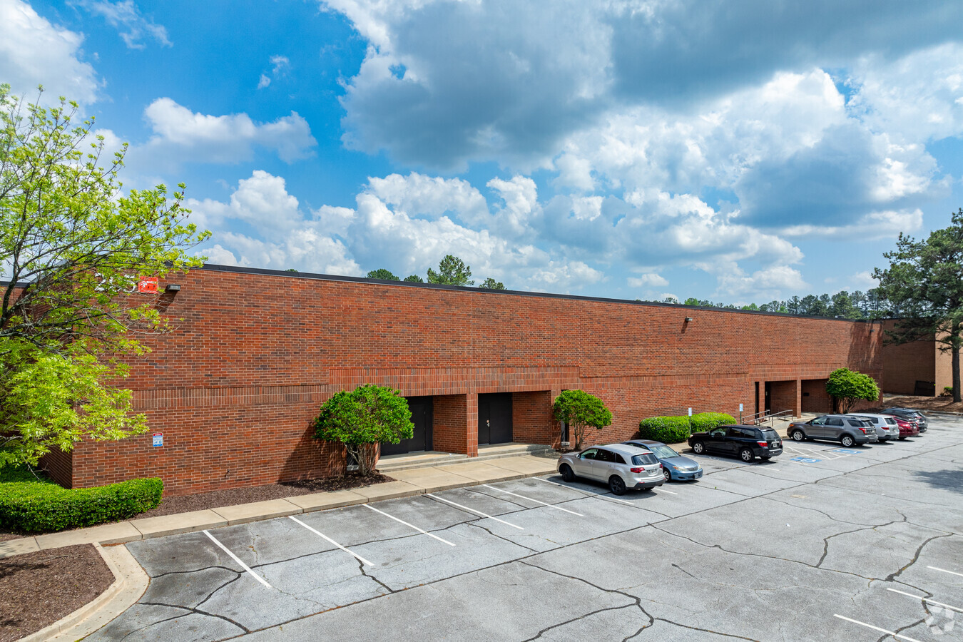
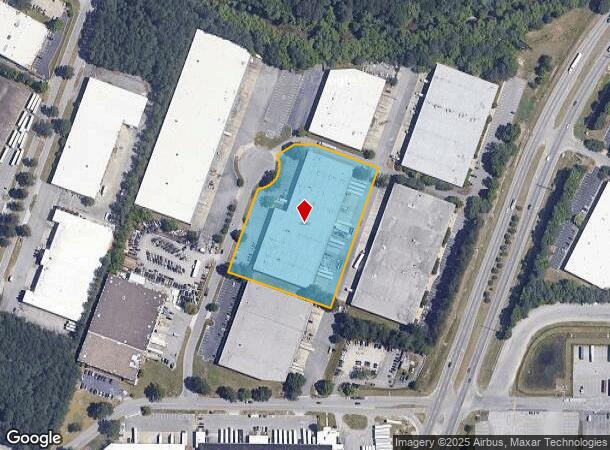
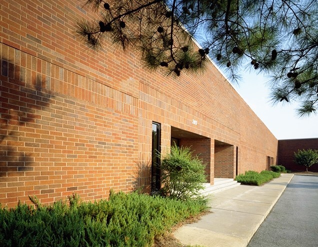
Property Record
205 Bucknell Ct Sw, Atlanta, GA 30336
NEARBY LISTINGS FOR SALE OR LEASE
Property Detail
205 Bucknell Ct Sw
Warehouse
Fulton
AE
Georgia
13121C0327F
3.56 AC
2023
Fulton District
2023
Atlanta
010312
Atlanta-Sandy Springs-Roswell, GA
81,649 SF
14F-0111-LL-091-1
DEMOGRAPHICS near 205 Bucknell Ct Sw
1 Mile
3 Mile
5 Mile
2024 Total Population
678
28,960
109,194
2029 Population
688
29,774
112,719
Pop Growth 2024-2029
+ 1.47%
+ 2.81%
+ 3.23%
Average Age
40
37
38
2024 Total Households
291
11,265
41,939
HH Growth 2024-2029
+ 1.72%
+ 2.93%
+ 3.28%
Median Household Inc
$78,928
$59,307
$59,613
Avg Household Size
2.30
2.50
2.50
2024 Avg HH Vehicles
2.00
2.00
2.00
Median Home Value
$288,194
$272,146
$245,603
Median Year Built
1983
1991
1988
Nearby Places
- Restaurants
- Banks
- Shops
- Fitness
- Groceries
PUBLIC TRANSPORTATION
AIRPORT
Hartsfield - Jackson Atlanta International
DRIVE
WALK
Distance
Hartsfield - Jackson Atlanta International
30 min
19.1 mi
Freight Ports
Georgia Ports - Savannah
DRIVE
WALK
Distance
Georgia Ports - Savannah
292 min
256.4 mi
SALE & LEASE HISTORY
LISTING DATE
SALE/LEASE

Oct 03, 2017
For Lease
Mar 01, 2017
For Lease
Jun 14, 2019
For Lease
Jul 03, 2023
For Lease
Feb 14, 2017
For Lease
Nearby Properties
Address
Land Use
TOTAL SIZE
Lot Size
Zoning
Address
Land Use
TOTAL SIZE
Lot Size
Zoning
454,000 SF
68.17 AC
LI-R
Address
Land Use
TOTAL SIZE
Lot Size
Zoning
295,590 SF
10.25 AC
MIX
Address
Land Use
TOTAL SIZE
Lot Size
Zoning
415,483 SF
23 AC
MIXU
Address
Land Use
TOTAL SIZE
Lot Size
Zoning
652,500 SF
52.87 AC
LI-R
Address
Land Use
TOTAL SIZE
Lot Size
Zoning
913,620 SF
58.88 AC
Address
Land Use
TOTAL SIZE
Lot Size
Zoning
359,608 SF
29.73 AC
DCD
Address
Land Use
TOTAL SIZE
Lot Size
Zoning
789,717 SF
68.55 AC
LI
Address
Land Use
TOTAL SIZE
Lot Size
Zoning
728,121 SF
48.95 AC
LI
Address
Land Use
TOTAL SIZE
Lot Size
Zoning
603,096 SF
38.38 AC
HI
Address
Land Use
TOTAL SIZE
Lot Size
Zoning
205,390 SF
24.28 AC
Address
Land Use
TOTAL SIZE
Lot Size
Zoning
567,480 SF
44.13 AC
LI
Address
Land Use
TOTAL SIZE
Lot Size
Zoning
340,131 SF
24.60 AC
DCD
Address
Land Use
TOTAL SIZE
Lot Size
Zoning
249,296 SF
17.10 AC
ACOND
Address
Land Use
TOTAL SIZE
Lot Size
Zoning
245,046 SF
18.09 AC
A1
Address
Land Use
TOTAL SIZE
Lot Size
Zoning
732,688 SF
47.23 AC
LI-R
Address
Land Use
TOTAL SIZE
Lot Size
Zoning
498,167 SF
11.18 AC
HI/WS
Address
Land Use
TOTAL SIZE
Lot Size
Zoning
538,748 SF
35.64 AC
LI
Address
Land Use
TOTAL SIZE
Lot Size
Zoning
540,000 SF
35.76 AC
DCD
Address
Land Use
TOTAL SIZE
Lot Size
Zoning
523,551 SF
50.92 AC
LI
Address
Land Use
TOTAL SIZE
Lot Size
Zoning
241,200 SF
18.40 AC
RM-12
Address
Land Use
TOTAL SIZE
Lot Size
Zoning
457,703 SF
72.15 AC
DCD
Address
Land Use
TOTAL SIZE
Lot Size
Zoning
729,946 SF
34.07 AC
M2
Address
Land Use
TOTAL SIZE
Lot Size
Zoning
290,784 SF
21.09 AC
RM-12
Address
Land Use
TOTAL SIZE
Lot Size
Zoning
266,725 SF
15.28 AC
A1
Address
Land Use
TOTAL SIZE
Lot Size
Zoning
611,500 SF
37.74 AC
M2
Address
Land Use
TOTAL SIZE
Lot Size
Zoning
479,591 SF
29.76 AC
LI-R
Address
Land Use
TOTAL SIZE
Lot Size
Zoning
592,677 SF
27.63 AC
MIA
Address
Land Use
TOTAL SIZE
Lot Size
Zoning
428,974 SF
26.57 AC
LI-R
Address
Land Use
TOTAL SIZE
Lot Size
Zoning
351,845 SF
29.99 AC
LI-R
Address
Land Use
TOTAL SIZE
Lot Size
Zoning
283,585 SF
22.75 AC
LI
The World's #1 Commercial Real Estate Marketplace
Connect with us
© 2025 CoStar Group
The information above has been obtained from sources believed reliable. While we do not doubt its accuracy we have not verified it and make no guarantee, warranty or representation about it. It is your responsibility to independently confirm its accuracy and completeness. Any projections, opinions, assumptions, or estimates used are for example only and do not represent the current or future performance of the property. The value of this transaction to you depends on tax and other factors which should be evaluated by your tax, financial, and legal advisors. You and your advisors should conduct a careful, independent investigation of the property to determine to your satisfaction the suitability of the property for your needs.